| Location: | Alachua County, Florida |
|---|---|
| Occupation Dates: | 1606 to 1706 (as mission site); earliest date of pre-Spanish Timucua settlement unknown |
| Excavator(s): | Charles Cobb; Kathleen Deagan; Charles Fairbanks; William Sears; Gifford Waters |
| Dates excavated: | 1956 (Goggin); 1964 (Sears and Fairbanks); 2006 (Deagan and Waters); 2024 (Cobb and Waters) |
Overview
The remains of mission San Francisco de Potano (also known as the Fox Pond site) are located in Alachua County, Florida, on the northern margin of the modern city of Gainesville. This mission was established in 1606 and lasted until 1706. Founded by Fray Martín de Prieto, it was the first doctrina (permanent mission with an assigned friar) in the interior of La Florida. It was placed in what was likely the principal town of the Potano Timucua cacique (chief), who had a number of subordinate towns where additional doctrinas and visitas were founded. San Francisco de Potano seems to have become the headquarters for the missions to the Western Timucua Indians.
The mission witnessed an eventful history. It was the principal center of the Timucua rebellion against the Spaniards in 1656, at which time the mission was abandoned. It was reestablished in 1659 after the rebellion was quelled. During the second half of seventeenth century it was a refugee center serving not only the Potano Timucuas, but also Native Americans displaced by slave raids carried out by English forces from South Carolina and their Indian allies. Demographic losses from epidemic diseases also led to the abandonment of surrounding missions and the coalescence of those populations with San Francisco de Potano. San Francisco de Potano itself was abandoned in 1706 before the continuing assault of slave raids and attacks instigated by Carolina, and the residents migrated to the mission system surrounding the capitol of St. Augustine.
The Fox Pond Site where mission San Francisco de Potano has been identified was first formally investigated in 1956 under the auspices of a Principles of Archaeology class at the University of Florida taught by John M. Goggin. Students conducted a brief excavation on the weekend of May 12 and 13 of that year. They also analyzed a surface collection from the site made by Jerry Evans, a local resident. No documentary evidence of this work or the results of the analyses has been located.
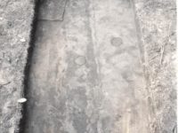
A subsequent field school from April 27 to May 28 of 1964 took place under the direction of William Sears and Charles Fairbanks (Symes and Stephens 1965). This included a number of hand-excavated units and the corresponding recovery of a large number of artifacts that included both Native American and Spanish materials. Based on the mix of artifacts and the presence of seventeenth-century majolica wares, the field school seemed to confirm the long-held suspicion that the Fox Pond site contained a Spanish mission. This was tentatively identified as San Francisco de Potano. However, no mission architecture was identified during the course of the excavations.
Definitive evidence for the presence of a mission was established when Kathleen Deagan and Gifford Waters conducted excavations at the Fox Pond site to coincide with the 400th anniversary of the founding of the mission in 1606 (Waters 2006). Their work, carried out between December of 2005 and July of 2006, involved metal detector coverage, a systematic shovel test pit survey, and the excavation of ten 1 x 2 meter units. These investigations were the first to identify a Spanish structure, possibly a friar’s residence or else a kitchen, confirming that Fox Pond contained a mission complex. The shovel test survey indicated that the site extended about 150 meters north-south and east-west. Based upon these results, Deagan and Waters prepared a successful nomination of the site to the National Register of Historic Places.
Documentary Evidence
Although San Francisco de Potano was established by fray Martín Prieto, the first description of the mission was made by fray Luís Jerónimo de Oré. Oré visited the colony of Florida on two occasions in order to investigate the organization of the missions and their success in converting Native Americans. His first visit in 1614 was in the capacity of Commissary General of the Indies. Individuals holding this position represented the Franciscan Order in New Spain and Central America and reported to the Minister General in Rome. After leaving this office and following a brief posting in Spain, Oré returned to Florida in 1616 in the role of visitor general. Oré summarized his investigations in the book Martyrs of Florida (Oré 1936). This work is recognized as a key primary source for the first Franciscan missions in the region. The brief account of the founding of San Francisco de Potano comes in the form of a first-hand declaration made by fray Prieto to fray Oré.
There are a number of first-hand descriptions of the various missions in interior Florida throughout the seventeenth century, typically from the accounts of church officials or from periodic “visitations” throughout the colony made by colonial delegates, such as governors. For missions among the Timucua Indians, these are best summarized by the discussions and references to be found in the volumes by John Worth (1998a, 1998b) and John Hann (1996). The book, The Cross in the Sand by Michael Gannon (1965), which addresses the history of the Catholic Church in Florida, is an important contextual study.
Excavation History, Procedure, and Methods
Fox Pond saw its first subsurface excavation on the weekend of May 12 and 13, 1956 by a University of Florida undergraduate field school under the direction of John Goggin. The students conducted survey and surface collection, and also examined and recoded a more selective surface collection belonging to a local resident.
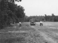
In 1964, limited subsurface testing was performed under the direction of William Sears and Charles Fairbanks, with the excavation carried out by a University of Florida field school from April 27 to May 28, 1964. The site was surveyed in a University of Chicago grid system with the main vertical axis made to conform to the edge of the hammock and stakes laid every 100 feet.
The temporary datum was later destroyed by a mower, so a level control was reestablished during that 1964 field season by backsighting on a blaze in the hammock whose height with reference to datum had been determined. The original excavation objective was to restrict excavation to the grass-covered roadway area until it was observed that there was a ridge of high ground to the north. It was then decided to try one test pit within the field area as well as other test pits within the hammock in order to determine the westward limits of the site. Excavation was carried out by the use of the arbitrary vertical level of 0.5 feet per level. In cases of pits and post holes the area was pedestaled and troweled to undisturbed soil.
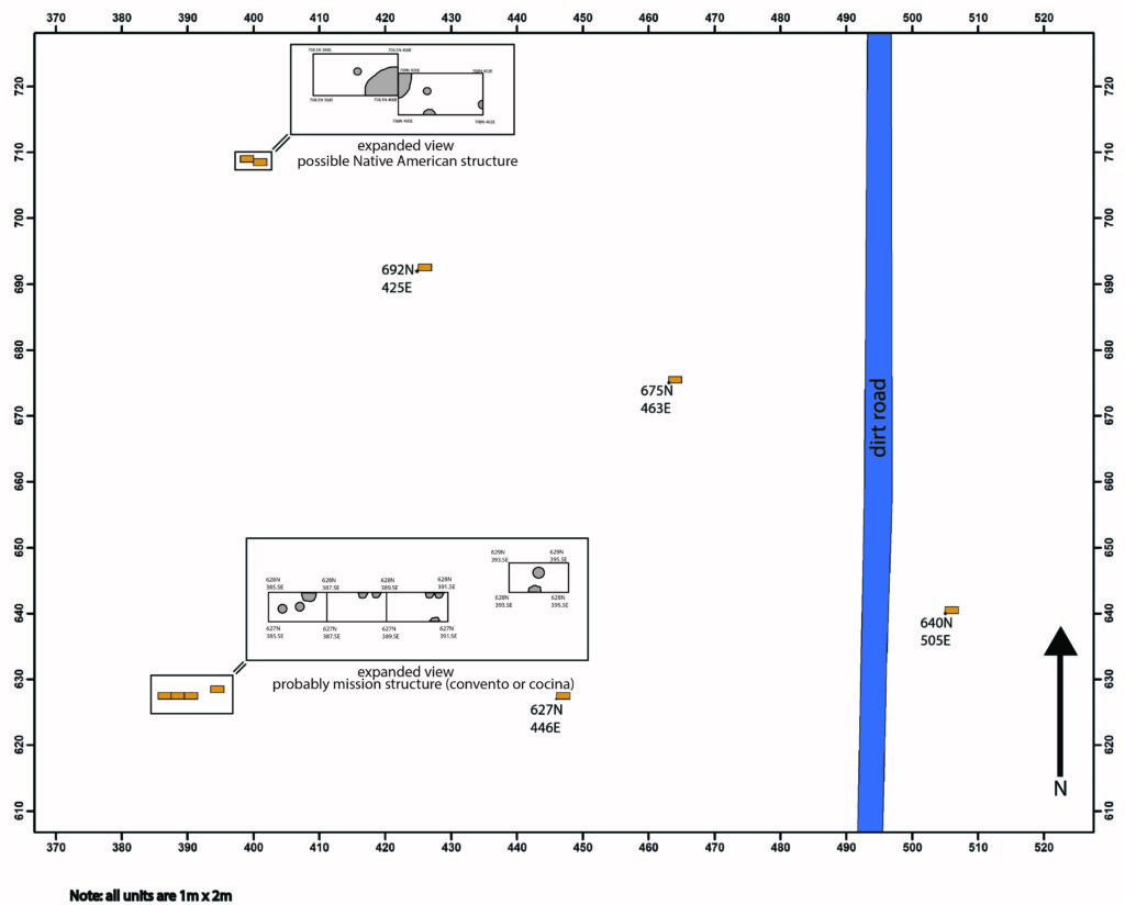
Unfortunately, there are no records recording the exact layout of the grid or the location of the excavation units from the first two field seasons. A base map from the excavations is housed at the Florida Museum of Natural History, and while the grid is not tied into any permanent points, the map depicts the north-south grass road on the IFAS property and allows for a close approximation to be made of the actual grid coordinates.
The majority of artifacts recovered from the 1956 and 1964 field seasons come from surface collections conducted on the agricultural field in the eastern part of the current survey area. Most of the excavation units were located immediately to the east of the north-south road, and limited excavations were carried out in the wooded hammock area to the west of the agricultural field. Materials recovered include Native American ceramics and lithics, historic ceramics, glass, beads, tools, and weapons.
It was after this time that the Fox Pond site was identified as the probable location of the remains of Mission San Francisco de Potano by Symes and Stephens (1965) even though it was not proposed and accepted for inclusion on the National Register of Historic Places until after the 2006 field season.
Between 2005 and 2006, new excavations were performed under the direction of Kathleen Deagan and Gifford Waters. The project was sponsored by a grant from the State of Florida, Department of State, Division of Historical Resources and was assisted by the Florida Historical Commission, the University of Florida Institute for Contact Period Studies, and the Florida Museum of Natural History. The project also included collaboration with Alachua County and the City of Gainesville
The primary goals of the first phase of that work were to locate the limits and associations of the site, which the team thought may encompass FMSF sites AL272, AL275, and AL276. They carried out sub-surface survey to assess the integrity of the deposits and the locations of mission activity within them as well as prepared a successful nomination of the site to the National Register of Historic Places. They also sought to produce historical and archaeological information on which to base popular publications, site markers, site exhibits, and future excavations.
Fieldwork and laboratory analyses were carried out between December 2005 and July 2006. Prior to field work, background research was conducted through the Florida Master Site Files (FMSF) SHAPE data files, Florida Department of Environmental Protection (FDEP) land survey document search, historical documents, aerial photographs, maps, and previous surveys in the area.
Shovel tests were conducted at 25-meter intervals throughout the 2.6-hectare project area, where an arbitrary 500 North 500 East point was placed in the approximate area of Goggin’s 0-0 point from 1956. The grid north was set as a magnetic north using a compass, and a laser total station was used to tie in the grid to modern structures on the IFAS property so that the grid could be reestablished in the future. All subsurface shovel tests were approximately 50 centimeters square by one meter deep (subsurface conditions permitting). Cultural materials were retained for analysis and identification and units were backfilled upon completion.
Subsurface survey was supplemented by surface inspection in the areas of exposed soil. Additionally, a metal detector survey was carried out in an effort to find areas associated with subsurface remains of Spanish structures which may have had nails and other metal artifacts. Positive hits with the metal detector were flagged and judgmentally tested with standard-sized shovel tests. Grid locations of positive hits were not recorded except for those subjected to shovel testing.
Based on the results of shovel tests and metal detector surveys, a total of ten 1-meter by 2-meter test units were excavated in areas of high artifact density and metal detector hits that yielded likely early Spanish colonial metal artifacts. Some units were also placed adjacent to productive units excavated during the 1964 field season. All test units were hand excavated with trowels and shovels in natural stratigraphic zones divided into 10-centimeter arbitrary levels and all soil was screened through ¼-inch hardware cloth. The dense hammock made it difficult to tie all units into a standard datum plane, thus line levels were established and tied into ground surface elevations. All elevation measurements for test excavation units are based on line level elevations associated with each individual unit.
Field notes recorded unit location, soil, stratigraphy, presence or absence of cultural materials with rough counts, dominant vegetation cover, and proximity to cultural or natural features. Sheet deposits covering the entire site were designated Zones, and soil stains associated with potentially identifiable areas of human activity were designated Features, while anomalous soil stains were classified as Areas. All features, areas, postmolds, and postholes were isolated and excavated separately, with soil samples being retained.
A map was maintained showing the location of all test units and identified cultural remains, and rough artifact density maps were drawn based on the data collected during the shovel test survey.
Summary of Research and Analysis
Recovered Native American artifacts indicate that this is a multi-component site, characterized by intermittent Archaic occupations and a long-term protohistoric and historic Native American occupation. Spanish artifacts recovered from the survey indicate a 17th century historic occupation. The presence of non-local Indigenous ceramics may indicate a post-Timucua Rebellion occupation of the site when the mission served as a place of refuge for displaced mission Indians.
The highest proportion of European artifacts came from one test unit located in the central portion of the site, supporting the interpretation that this was the area of most intensive Spanish occupation. The majority of the Spanish artifacts recovered date to the early part of the 17th century, and of particular importance was the recovery of specific Spanish ceramics such as Guadalajara Polychrome, Puebla Polychrome, and San Agustin Blue on White. All of these date from the second half of the 17th century and were likely deposited after the 1656 Timucua rebellion. This is significant because only San Francisco de Potano was reoccupied after the rebellion and lends support to its designation in this location.
It is highly likely that the Fox Pond site contains the remains of both the pre- and post-Timucua Rebellion manifestations of Mission San Francisco de Potano. Current interpretations of the site suggest that the pre-Rebellion mission center was located in the eastern portion of the site in what is now an agricultural field. The western portion of the site is where the post-1650 artifacts discussed above were located, indicating that this area was most likely occupied after the rebellion.
While the exact layout of the mission settlement has not yet been determined, preliminary analysis indicates a centralized area of Spanish occupation and a surrounding Native American village area. This general layout is similar to that found on other previously excavated Spanish missions such as Fig Springs and Baptizing Springs (Loucks 1979 and 1993; Milanich 1972; Weisman 1992). The Spanish structure, tentatively identified as the friars residence or cocina, was discovered as a result of the metal detector survey and subsequent test excavations. The metal detector survey also recorded a cluster of positive hits to the north of the excavated structure. Shovel tests in this area uncovered additional iron nails, majolica, and glass beads, however time constraints did not allow for the excavation of test units in this area. While uncertain until excavations can be undertaken in this area, it is possible that this area represents the remains of the mission church. If this is true, it is likely that the mission’s cemetery would be found either under the floor of the church or adjacent to the structure.
Gifford Waters and Charles Cobb
Florida Museum of Natural History
University of Florida, Gainesville, FL
August 2019
Site Grid
Field records from the excavations at the Fox Pond site in 1956 and 1964 indicate that the same grid system was likely used for both excavations. While there are no records recording the exact layout of the grid, a base map of the excavations is housed at the Florida Museum of Natural History. It depicts the north-south grass road at the site and allows for a close approximation of the actual grid coordinates used in 1956 and 1964. All measurements from the 1956 and 1964 field seasons were in feet and inches.
The 2006 field season established an arbitrary 500 North 500 East point in the approximate area of the 1956 0-0 point. Grid north was set as magnetic north and a laser total station was used to tie in the grid to modern structures on the site. All measurements from the 2006 field season were recorded in meters and centimeters.
Survey and Excavation Methods
The 2006 shovel test survey of the site was conducted on a 25-meter grid interval throughout the site in an effort to establish the site boundaries. Shovel tests measured approximately 50-centimeter square by one meter deep (subsurface conditions permitting). Tests were excavated by natural levels and all soil was screened through ¼” hardware cloth. Test units measuring 1-meter by 2-meters were placed in areas of high artifact concentration located in the shovel test survey. Additional test units were placed in an area of multiple positive hits of a metal detector survey. All test units were excavated in natural stratigraphic zones divided into 10-centimeter arbitrary levels.
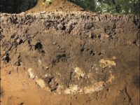
The dense hammock made it difficult to tie all units in to a standard datum plane, thus all elevations were recorded as centimeters below surface for each unit. Sheet deposits covering the entire site were designated zones (Z1, Z2, and Z3 throughout the site). Soils stains associated with potentially identifiable areas of human activity were designated features (F1, F2, etc.), while anomalous soils stains were classified as areas (A1, A2, etc. for each unit). Postmolds and postholes were also identified within the excavation units (PPM1, PPM2, etc. for each unit). All features, areas, postmolds, and postholes were isolated and excavated separately. All soil was screened through ¼” hardware cloth.
Field records for the site are extremely limited from the 1956 and 1964 excavations. The 2006 excavations include a standard form for all shovel tests, as well as a field notebook, plan view and profile maps of test units, digital images of excavations, a field specimen (FS) log, and excavation unit record forms.
Features Associated with Native Village Area
| Feature | Feature Type | Unit Corner |
| F1 | Pit | 708.5N 398E |
| F2 | Determined not a feature | 708.5N 398E |
Features Associated with Probable Kitchen
| Feature | Feature Type | Unit Corner |
| F3 | Post and Post hole | 628N 393.5E |
| F4 | Possible Post | 628N 393.5E |
| F5 | Determined not a feature | 628N 393.5E |
| F6 | Post and Post hold | 628N 393.5E |


