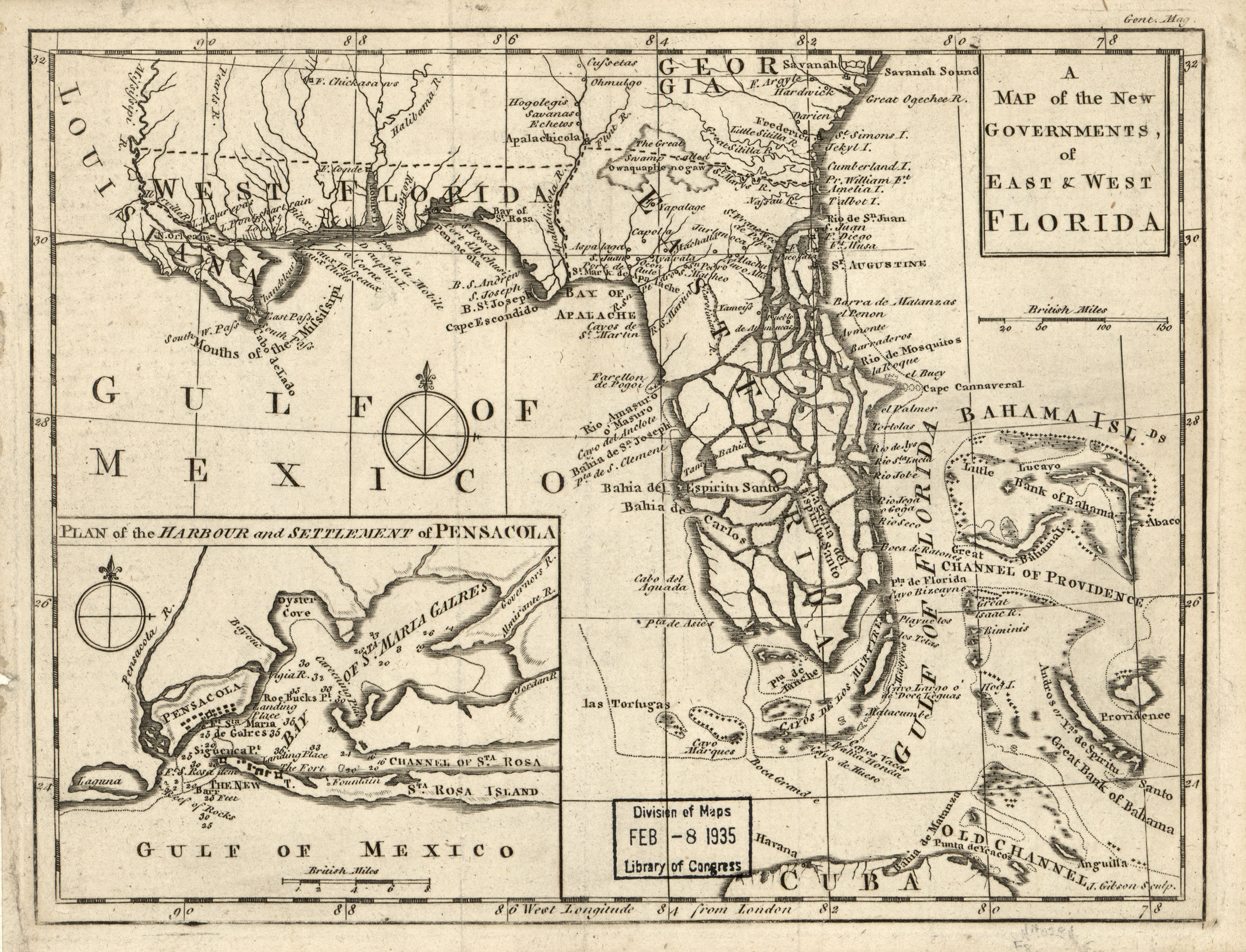
A map of the British and French dominions in North America
Mitchell, John, Thomas Kitchin, and Andrew Millar. A map of the British and French dominions in North America, with the roads, distances, limits, and extent of the settlements, humbly inscribed to the Right Honourable the Earl of Halifax, and the other Right Honourable the Lords Commissioners for Trade & Plantations. [London; Sold by And: Millar i.e. 1757, 1757] Map. https://www.loc.gov/item/74693175/.